Rating of the best navigators for Android for 2025

A navigator is a device that will help you navigate your current location and arrive at your destination faster. And in large cities, GPS navigators provide another indispensable help: they provide information about traffic jams and offer a freer route.
Many modern smartphones are equipped with GPS, which communicates with the satellite. Thanks to this, it becomes possible to find the location of the phone at the moment.
Let's review the most popular GPS navigators in 2025 that are installed on the Android operating system.

Content [Hide]
What types are
By variety, navigators can be divided into several categories: those that work using an Internet connection and those that work offline.
Online applications are more functional. They more accurately show the user's location, the presence of traffic jams, in the event of a traffic accident or repair of a section of the road, the navigator will display this fact and suggest a more optimal route.
They also have several other features and advantages over offline navigators - they offer restaurants and cafes, show gas stations with cheaper fuel prices. Some applications may provide information about the presence of cameras that capture the speed of the driver and the location of police posts. This is undoubtedly a very useful feature.
But there is also a significant disadvantage - there is not always a good coverage of the mobile network and, accordingly, a high-quality Internet connection. When driving on roads in large cities, the driver will not encounter such a problem, but when walking into the forest, there is a chance of getting lost.

For pedestrians, online navigators provide timetables and stops for almost all types of public transport. It will show which minibus or bus number you need to take and which stop to get off to reach your destination.
In navigators that work without an Internet connection, most maps of different cities are preloaded. When building a route, the application indicates a fast and convenient option for the driver or pedestrian, but may not take into account the nuances that arose during the journey. For example, if an accident occurs on a given route or there is currently a large traffic jam, the user will know about it when they reach this section.
Such applications are best used in the absence of mobile Internet. You only need to download the desired map in advance and specify the desired route.
It is also worth noting that applications are free and those that can be purchased. For familiarization, the user is usually given a trial time for a certain period and at the end of it he is offered to purchase the full version.

How to choose
When choosing a navigation program, you need to focus on several indicators. First of all, the choice depends on for which user the product is purchased - a pedestrian or a motorist. Almost all applications are suitable for both types, but some contain more features for drivers than for tourists, and vice versa.
For example, a motorist needs to choose a device that not only indicates the correct and most optimal route, taking into account traffic jams or accidents, but also notifies of the nearest traffic police posts or traffic cameras.
A pedestrian, on the other hand, does not need this information at all; it is much more useful for him to familiarize himself with the schedule of public transport or the nearest crossings in big cities. Some navigators show what attractions are in cities and how to get to them. For a tourist, this function is necessary, it will significantly save search time. Displaying the nearest cafes, restaurants or shops in the navigator is also a very nice feature.
The navigator should have a completely accessible and understandable interface - not everyone will have the opportunity to deal with the program already on the way.
Maps of cities and streets must be worked out to the smallest detail. It is also important to pay attention to this criterion.It is much more convenient to search for an object if it is marked on the map not only with the name of the street, but also with the numbering of houses.
Typically, maps are rendered in 2D. Some navigators show in 3D format - the image becomes three-dimensional, which is very convenient when searching for a specific building.
Another important selection criterion for the type of navigator is whether it works online or without an Internet connection. As mentioned earlier, it is better to choose depending on this indicator. With expensive roaming or no mobile Internet at all, it is definitely better to choose from applications that have the necessary maps preloaded. But do not forget that online navigators will have more accurate information. This option is more suitable for vehicle drivers.
Given all the above recommendations, the final choice in the navigator for Android will not be difficult.
Where is the best place to buy
In any city there are stores selling household appliances. It is in them that a certain choice of navigators on the Android platform is provided. The larger the point of sale of household and electronic goods, the greater the range they have. Some stores are engaged in the delivery of products on order - if the right product is not available, then employees can order it from suppliers and inform the buyer when the electronics will be in place.
Another, better option with a wide selection is online shopping. Their obvious advantage is time saving - you don’t have to spend your personal time looking for the necessary electronics while traveling shopping. It is enough in a period of time free from work or household chores to sit down to view goods on the Internet.
If the user does not yet understand what criteria electronic equipment must meet, then he can simply view popular models or new arrivals. After reviewing the functionality and characteristics of the product, the buyer may be interested in any model.
Equally important are the reviews of customers who have already purchased the gadget in question. If there are any deviations from the manufacturer's description or inappropriate quality, this information will certainly be indicated by other users who have encountered a breakdown. Or vice versa: the products are of excellent quality, and previous buyers will be happy to point out this fact.
If a future buyer is looking for a specific model, then he can simply enter this name in the site's search engine. In the absence of a gadget, he can use the filter to search: by price, manufacturer, screen size, features.
When the buyer has finally decided on the model, all that remains is to place an order online, enter your details and wait for the delivery of the goods.
If the user has a smartphone on the Android operating system, he just needs to download the application from a specific site. By entering a query in the search engine, he is provided with many options for programs, from which the user will choose the best for himself.
After reviewing the detailed description and functions of the application, the buyer is already determined with the final choice. The installation usually does not cause any problems - following the step-by-step instructions, in a few minutes the user becomes the owner of a GPS navigator on his smartphone. All you need is high-speed mobile Internet or Wi-Fi.
On such a site, reviews deserve special attention, as well as when buying a gadget. Other users always write about frequent crashes in the program, inconvenient interface or incorrect information.
Programs are constantly being improved, so they need to be updated over time. For the convenience of users on the site, you can contact the developer and express your opinion about problems in the work or suggestions for improving the application.
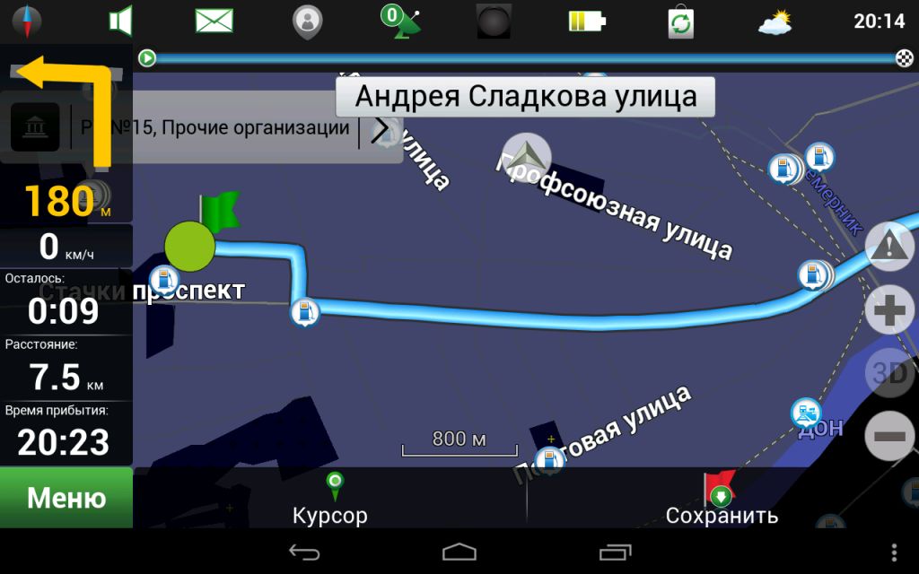
Rating of the best programs that work without an Internet connection
In this section, we will consider popular applications that can work offline. Since it is not always possible to connect to the Internet, these navigators will help you quickly navigate the area.
Yandex.Navigator
votes 1
votes 1

With this free program, you can find the fastest routes to your destination, as it will show you traffic jams, toll or repaired sections. The application will provide several options for the route and the estimated time of the entire route.
The program also has a setting that is necessary for truck drivers - in order not to drive on a road not intended for trucks, the navigator will warn about unwanted routes.
In the case when a stop for rest or a snack is necessary, the locations of cafes, pharmacies, shops or gas stations are indicated on the map.
It is worth noting that the application can be controlled by the Alice voice assistant. With its help, building a route or searching for the necessary organizations is established much faster than with manual data entry.
You can get acquainted with the situation on the road using this application not only in Russia, but also in Georgia, Tajikistan, Turkey, Ukraine, Armenia and other countries.
A function is available that reports the availability of parking within certain areas of Moscow and several large cities of the Russian Federation.
The Russian-language interface is easy to use. Suitable not only for car users, but also for pedestrians – you can find out the working hours, routes and stops of public transport, as well as the presence of pedestrian crossings.
Advantages:
- Completely user-friendly interface;
- The presence of a voice assistant;
- Convenient for pedestrians and drivers;
- Has many features;
- The application is free.
Flaws:
- Some features require an internet connection.
Navitel
votes 1
votes 1
For review, the user can download a free 7-day version. The navigator has a very clear interface, which is easy to figure out on your own.
With the purchase of the application, the car driver receives the following functions: maps with detailed visualization of 67 countries, quick construction of a given route, information about traffic jams, traffic accidents, surveillance camera locations and road sections with repair work.
The program supports 3D maps and 3D junctions, can calculate the correct route for trucks by choosing the roads intended for trucks.
The application is equipped with several languages, controlled by a voice assistant or by pressing the smartphone screen. The device also supports a route with multiple preset stops.
The following offline country maps are available, which the user receives after the complete purchase of the program: Belgium, Austria, Greece, Georgia, Norway, Italy, Turkey, Russia, Ukraine and many others. With the help of this navigator, you can travel freely without fear of getting lost in unknown places.
Advantages:
- Supports maps of many countries offline;
- Voice control;
- Shows accidents, cameras, traffic jams.
Flaws:
- Does not show small settlements;
- Refers to paid software;
- After the update, users report crashes.
2 GIS
votes 0
votes 0
The functions that the device offers are suitable for both the driver and the pedestrian. The following features will be available in the car:
- traffic jams are noted;
- warns about the presence of cameras that record the speeding of the car;
- displays toll and unpaved road sections;
- suggests the correct route for trucks;
- it is possible to build a route at several points.
For hikers, the navigator has even more features. He acts as a reference: he will inform you about the work schedule, provide phone numbers, as well as websites of the desired enterprise.
You can also get acquainted with the schedule of public transport, including trams and trolleybuses, metro stations, as well as their stops. It will tell you which bus number you need to take and where to get off in order to quickly get to your destination.
There is information about establishments that deliver food to the address, hardware stores, cafes and restaurants.
Another interesting feature that not many navigators have is the search for the necessary medicines in the nearest pharmacies and their cost.
The software is absolutely free and contains maps of more than 50 cities in Russia and beyond.
Advantages:
- Free application;
- Lots of opportunities for pedestrians;
- Focused on trucks;
- Loaded a large number of cities;
- Shows accidents, cameras and traffic jams.
Flaws:
- It does not always correctly show the user's geolocation.
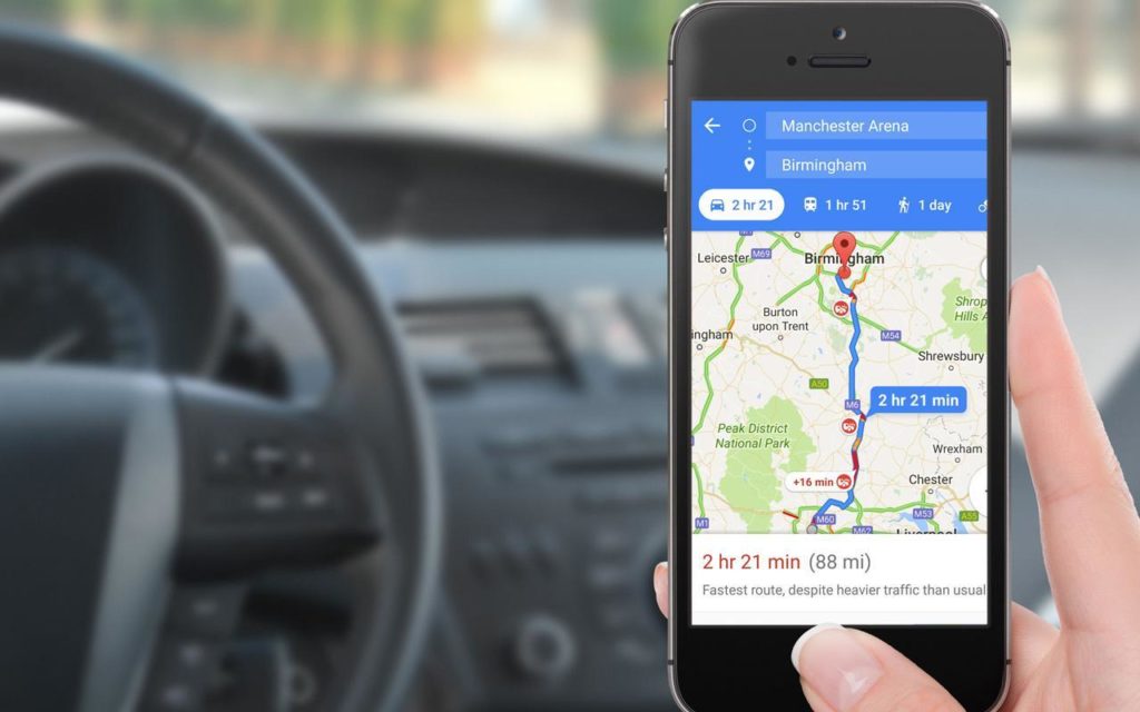
Rating of high-quality online GPS navigators
Let's review the best programs at the moment, which require a Wi-Fi connection or high-speed mobile Internet.
Sygic
votes 0
votes 0
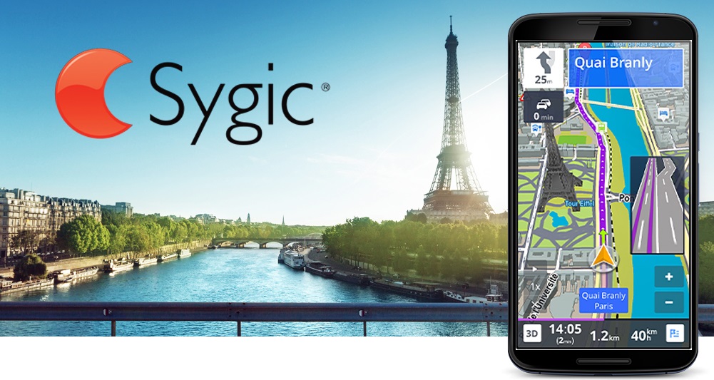
The application is paid, to get acquainted with it, the user is given time within 7 days, during which he can test the program for free. After this time, you can purchase the paid version in full or use the free version with a limited number of functions. The final amount upon purchase will depend on the choice of cards that the device will have. You can download some regions or the whole world. Subsequent updates do not require material costs.
Sygic supports offline 3D maps. With the help of the program, the driver of the car will be able to avoid traffic jams, change lanes in time. If the route is unfamiliar to the driver, the navigator will adjust the most optimal road option.
Management is due to the voice assistant. Also, the navigator will be useful for pedestrian users - alerts about the nearest crossings will significantly reduce the search time.
When the Internet is connected, the user opens up much more opportunities: you can record a video of the trip, that is, the application acts as a video recorder, warns about cameras on the road, and informs about parking spaces. The program will also notify you of fuel prices when you set up this feature.
Advantages:
- Multifunctionality;
- Free testing for 7 days;
- It is possible to work without an Internet connection (if you download maps in advance);
- Records a video of the path.
Flaws:
- Paid software;
- Sometimes indicates the wrong route.
Waze
votes 0
votes 0

Free software is ideal for car drivers, it lacks functionality for pedestrians.
By installing this application, the user learns not only about traffic jams on his route, but also about the location of police posts that may be encountered on his way. It also marks the roads that are currently under repair and about traffic accidents.
With the help of the program, you can find out about the cost of fuel at gas stations that appear along a given route. Of the proposed options, you can refuel with the cheapest fuel.
Information is updated at the expense of other users who have encountered road problems along the way. The driver is also given a choice of several voice options.
Advantages:
- Free application;
- Clear interface;
- Accurate road information;
- You can refuel with inexpensive fuel;
- Warns of police posts.
Flaws:
- Few features for pedestrians.
Google Maps
votes 0
votes 0
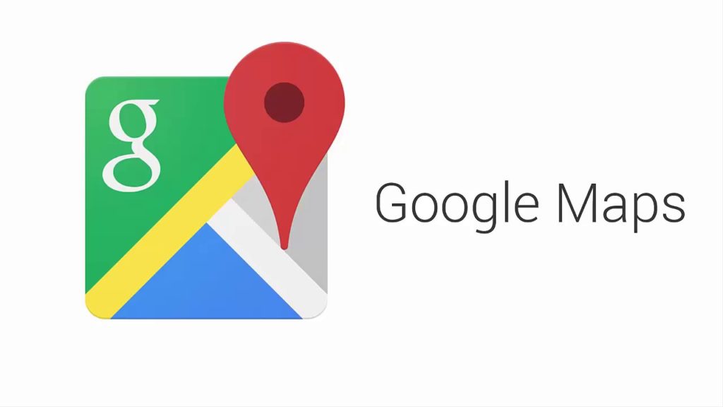
All smartphones on the Android operating system already have this software installed. In it you can get acquainted with maps of 220 countries of the world, find out the location of all the famous places in different cities, which are worth visiting when traveling.
When building a route, the navigator shows the most correct time after which the user will reach the destination. It takes into account traffic jams, traffic congestion and accidents that occurred on the site.
In addition to traffic accidents, Google Maps will help you find quality restaurants and cafes so that you can have a bite to eat and relax.
If you create a route in advance, with the Internet connected, the application will build the most optimal road.But it should be borne in mind that accidents that may have occurred on the site will not be displayed without connection.
Also, the navigator is not designed to work with trucks, it will not be able to build a route, taking into account the characteristics of the vehicle.
Advantages:
- Works offline with a pre-selected route;
- Available on all Android phones.
Flaws:
- Not suitable for trucks and large vehicles;
- Sometimes it shows the wrong location.
All of the above Android navigator models are the most popular among users in 2025. All of them have certain positive qualities and some disadvantages. But such applications make it much easier to travel to uncharted places or walk around an unfamiliar city.
With the help of these programs, the driver of the car will be able to get to the destination faster, bypassing traffic jams or accidents, and will also get acquainted with the situation on the given route as a whole. And the pedestrian will not have to ask every passer-by how to get to the right organization or other institution.
new entries
Categories

The best men's sneakers in 2025
Views: 124031

The Best Complex Vitamins in 2025
Views: 121938


The best waterproof trail running shoes in 2025
Views: 1520
Top Towbar Manufacturers 2025
Views: 8225

Useful
Ranking of the best vacuum sealers for 2025
Views: 1935

Rating of the best electric hobs for 2025
Views: 2340


Best Antivirals in 2025
Views: 33333
Top 15 hoverboards of 2025. Decent value for money
Views: 29338
Popular Articles
-
Top ranking of the best and cheapest scooters up to 50cc in 2025
Views: 131650 -

Rating of the best soundproofing materials for an apartment in 2025
Views: 127689 -

Rating of cheap analogues of expensive medicines for flu and colds for 2025
Views: 124517 -
The best men's sneakers in 2025
Views: 124031 -
The Best Complex Vitamins in 2025
Views: 121938 -

Top ranking of the best smartwatches 2025 - price-quality ratio
Views: 114978 -

The best paint for gray hair - top rating 2025
Views: 113393 -

Ranking of the best wood paints for interior work in 2025
Views: 110318 -

Rating of the best spinning reels in 2025
Views: 105327 -

Ranking of the best sex dolls for men for 2025
Views: 104363 -

Ranking of the best action cameras from China in 2025
Views: 102215 -

The most effective calcium preparations for adults and children in 2025
Views: 102010